Geolocate

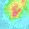
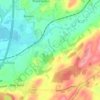
Morecambe topographic map

Click on the map to display elevation.

About this map

Name: Morecambe topographic map, elevation, terrain.

Location: Morecambe, Lancaster, Lancashire, England, United Kingdom (54.04973 -2.91764 54.11485 -2.82105)

Average elevation: 3 m

Minimum elevation: 0 m

Maximum elevation: 58 m

Other topographic maps

Click on a map to view its topography, its elevation and its terrain.

Dolphinholme

United Kingdom > England > Lancashire > Lancaster

Average elevation: 100 m

Warton Crag

United Kingdom > England > Lancashire > Lancaster > Warton

Average elevation: 45 m

Stodday

United Kingdom > England > Lancashire > Lancaster

Average elevation: 26 m

Bailrigg

United Kingdom > England > Lancashire > Lancaster

Average elevation: 58 m

Hest Bank

United Kingdom > England > Lancashire > Lancaster

Average elevation: 25 m

Lower Burrow

United Kingdom > England > Lancashire > Lancaster > Bailrigg

Average elevation: 36 m

Capernwray

United Kingdom > England > Lancashire > Lancaster

Average elevation: 60 m

Brookhouse

United Kingdom > England > Lancashire > Lancaster

Average elevation: 82 m

Hayshaw Fell

United Kingdom > England > Lancashire > Lancaster

Average elevation: 226 m

Arkholme

United Kingdom > England > Lancashire > Lancaster

Average elevation: 57 m

Lowgill

United Kingdom > England > Lancashire > Lancaster

Average elevation: 206 m

Hornby

United Kingdom > England > Lancashire > Lancaster

Average elevation: 56 m

Galgate

United Kingdom > England > Lancashire > Lancaster

Average elevation: 43 m

Glasson Dock

United Kingdom > England > Lancashire > Lancaster

Average elevation: 7 m

Melling

United Kingdom > England > Lancashire > Lancaster

Average elevation: 51 m

Littledale

United Kingdom > England > Lancashire > Lancaster

Average elevation: 255 m

Notts Pot

United Kingdom > England > Lancashire > Lancaster > Leck

Average elevation: 357 m

Halton

United Kingdom > England > Lancashire > Lancaster

Average elevation: 60 m

Ward's Stone

United Kingdom > England > Lancashire > Lancaster

Average elevation: 478 m

Aldcliffe

United Kingdom > England > Lancashire > Lancaster

Average elevation: 23 m

Clougha Pike

United Kingdom > England > Lancashire > Lancaster

Average elevation: 319 m

Halton

United Kingdom > England > Lancashire > Lancaster

Average elevation: 60 m

White Hill

United Kingdom > England > Lancashire > Lancaster

Average elevation: 455 m

Aldcliffe

United Kingdom > England > Lancashire > Lancaster

Average elevation: 23 m

Gear up for your next adventure:

🥘Camping Cookware Set - Compact nesting pots and pans for trail cooking
🥾Approach Boots - Comfortable boots for hiking and climbing approaches
🛌Down Sleeping Bag - Superior warmth-to-weight ratio for cold nights
🗺️Topographic Maps - Detailed maps to explore trails, mountains, and wilderness areas
⛺Tent Footprint - Protect tent floor and increase durability

As an Amazon Associate, this site earns from qualifying purchases at no extra cost to you.