
Redwood Valley topographic map
Click on the map to display elevation.
Redwood Valley
Redwood Valley (formerly Basil) is a census-designated place (CDP) in Mendocino County, California, United States. It is located 9 miles (14 km) north of Ukiah, the county seat, at an elevation of 722 feet (220 m), and comprises the northern portion of the Ukiah Valley. It is about 15 miles (24 km) southeast of Willits. Potter Valley is to the east and Calpella to the south. The ZIP Code is 95470, and the community is in area code 707. The population of the CDP was 1,843 at the 2020 census.
About this map
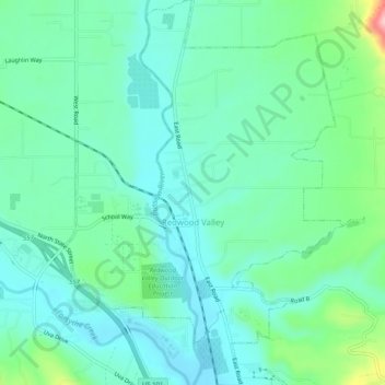
Name: Redwood Valley topographic map, elevation, terrain.
Average elevation: 246 m
Minimum elevation: 205 m
Maximum elevation: 383 m
Other topographic maps
Click on a map to view its topography, its elevation and its terrain.
Boonville
United States > California > Mendocino County
Boonville (formerly The Corners and Kendall's City) is a census-designated place (CDP) in Mendocino County, California, United States. It is located 12.5 miles (20 km) southwest of Ukiah, at an elevation of 381 feet (116 m). The population was 1,018 at the 2020 census.
Average elevation: 168 m
Laytonville
United States > California > Mendocino County > Laytonville
Laytonville is a census-designated place (CDP) in Mendocino County, California, United States. Laytonville, is located 20 miles (32 km) north-northwest of Willits, at an elevation of 1670 feet (509 m). The population was 1,227 at the 2010 census, down from 1,301 at the 2000 census.
Average elevation: 536 m
Philo
United States > California > Mendocino County
Philo is a census-designated place in Mendocino County, California, United States. It is located 6 miles (10 km) northwest of Boonville, at an elevation of 331 feet (101 m). The population was 319 at the 2020 census.
Average elevation: 111 m
Comptche
United States > California > Mendocino County
Comptche (Pomo: Compatche, meaning "In the valley among the hills") is an unincorporated community and census-designated place (CDP) in Mendocino County, California, United States. It is located 17 miles (27 km) southeast of Fort Bragg at an elevation of 187 feet (57 m). The population was 167 at the 2020…
Average elevation: 134 m
Philo
United States > California > Mendocino County
Philo is a census-designated place in Mendocino County, California, United States. It is located 6 miles (10 km) northwest of Boonville, at an elevation of 331 feet (101 m). The population was 319 at the 2020 census.
Average elevation: 111 m
Fort Bragg
United States > California > Mendocino County > Fort Bragg
Fort Bragg, officially the City of Fort Bragg, is a city along the Pacific Coast of California along Shoreline Highway in Mendocino County. It is 24 mi (39 km) west of Willits, at an elevation of 85 feet (26 m). Its population was 6,983 at the 2020 census.
Average elevation: 29 m
Anderson Valley
United States > California > Mendocino County
The climate is tempered by cool marine air. Steep hills and mountains surround rolling to nearly level alluvial terraces. The dominant natural vegetation is a mixed forest of Coast Redwood, various native oak varieties, and Douglas fir. Elevation ranges from sea level to 2,500 feet (760 m). The average annual…
Average elevation: 129 m
Laytonville
United States > California > Mendocino County > Laytonville
Laytonville is a census-designated place (CDP) in Mendocino County, California, United States. It is located 23 miles (37 km) north-northwest of Willits, at an elevation of 1,670 feet (510 m). The population was 1,152 at the 2020 census, down from 1,227 at the 2010 census.
Average elevation: 536 m
Brooktrails
United States > California > Mendocino County
Brooktrails is in central Mendocino County, occupying hills to the west of Little Lake Valley. The fire department and golf course lie at an elevation of 1,634 feet (498 m), but the community's western edge rises to nearly 3,000 feet (910 m). It is 3 miles (5 km) north of Willits. According to the United…
Average elevation: 569 m