Geolocate

Ilomavis topographic map

Click on the map to display elevation.

About this map

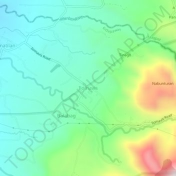
Name: Ilomavis topographic map, elevation, terrain.

Location: Ilomavis, North Cotabato, Soccsksargen, 9400, Philippines (7.01692 125.17207 7.05692 125.21207)

Average elevation: 809 m

Minimum elevation: 574 m

Maximum elevation: 1,411 m

Other topographic maps

Click on a map to view its topography, its elevation and its terrain.

Lake Jordan

Philippines > North Cotabato > Makilala

Average elevation: 2,383 m

President Roxas

Philippines > North Cotabato

Average elevation: 364 m

Gear up for your next adventure:

🍽️Titanium Camping Spork - Ultralight and indestructible eating utensil
🥘Camping Cookware Set - Compact nesting pots and pans for trail cooking
🧤Rechargeable Heated Gloves - Extreme warmth for Canadian winter expeditions
🔨Vehicle Emergency Tool - Safety tool for remote road trips to trailheads
🥽Outdoor Goggles - Protective eyewear for outdoor activities

As an Amazon Associate, this site earns from qualifying purchases at no extra cost to you.