Geolocate

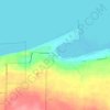
Burt Township topographic map

Click on the map to display elevation.

About this map

Name: Burt Township topographic map, elevation, terrain.

Location: Burt Township, Alger County, Michigan, 49839, United States (46.50475 -86.36520 46.69025 -85.86444)

Average elevation: 238 m

Minimum elevation: 175 m

Maximum elevation: 354 m

Other topographic maps

Click on a map to view its topography, its elevation and its terrain.
Kiva

United States > Michigan > Alger County

Average elevation: 310 m

Christmas

United States > Michigan > Alger County

Average elevation: 203 m

Indian Town

United States > Michigan > Alger County

Average elevation: 270 m

Gear up for your next adventure:

🥾Lightweight Hiking Shoes - Comfortable shoes for day hikes
🧥Softshell Jacket - Windproof and breathable jacket for hiking
🧭GPS Outdoor Watch - Smart watch for navigation and fitness tracking in nature
🚲MTB Frame Bag - Carry tools and maps directly on your bicycle frame
🥾Waterproof Hiking Boots - Boots keeping your feet dry in wet conditions

As an Amazon Associate, this site earns from qualifying purchases at no extra cost to you.