Geolocate

Kiva topographic map

Click on the map to display elevation.

About this map

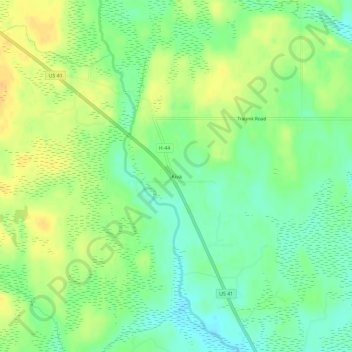
Name: Kiva topographic map, elevation, terrain.

Location: Kiva, Limestone Township, Alger County, Michigan, United States (46.23384 -87.10459 46.27384 -87.06459)

Average elevation: 310 m

Minimum elevation: 295 m

Maximum elevation: 325 m

Other topographic maps

Click on a map to view its topography, its elevation and its terrain.

Onota Township

United States > Michigan > Alger County

Average elevation: 228 m

Munising

United States > Michigan > Alger County

Average elevation: 213 m

Munising

United States > Michigan > Alger County > Munising

Average elevation: 213 m

Gear up for your next adventure:

🔋Emergency Crank Radio - Weather alerts and power without needing batteries
🐕Hiking Dog Pack - Let your canine companion carry their own water and food
🏃Hydration Running Vest - Carry water and maps close to your body for speed
🧊Portable Cooler - Keep food and drinks cold during outdoor adventures
🔥Camping Stove - Portable stoves to cook outdoors with ease

As an Amazon Associate, this site earns from qualifying purchases at no extra cost to you.