Geolocate

Ventotene topographic map

Click on the map to display elevation.

About this map
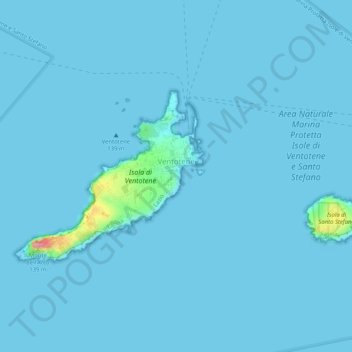
Name: Ventotene topographic map, elevation, terrain.

Location: Ventotene, Latina, Lazio, 04031, Italy (40.78493 13.40767 40.80383 13.45895)

Average elevation: 4 m

Minimum elevation: 0 m

Maximum elevation: 130 m

Other topographic maps

Click on a map to view its topography, its elevation and its terrain.

Santo Stefano island

Italy > Lazio > Latina > Ventotene

Average elevation: 2 m

Ventotene island

Italy > Lazio > Latina > Ventotene

Average elevation: 7 m

Palmarola

Italy > Lazio > Latina > Ponza

Average elevation: 13 m

Borgo Sabotino

Italy > Lazio > Latina > Latina

Average elevation: 5 m

Gear up for your next adventure:

🥾Approach Shoes - Shoes designed for climbing approaches and rugged trails
⛺Backpacking Tent - Lightweight tent for long-distance hiking trips
💡Portable Camping Lamp - Rechargeable lamp for campsite lighting
🧥Waterproof Pants - Keep dry during rainy hiking conditions
🥾All-Terrain Hiking Boots - Versatile boots for varied hiking conditions

As an Amazon Associate, this site earns from qualifying purchases at no extra cost to you.