Geolocate

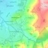
Prestbury topographic map

Click on the map to display elevation.

About this map

Name: Prestbury topographic map, elevation, terrain.

Location: Prestbury, Cheltenham, Gloucestershire, England, United Kingdom (51.90735 -2.08935 51.92962 -2.03268)

Average elevation: 103 m

Minimum elevation: 41 m

Maximum elevation: 319 m

Other topographic maps

Click on a map to view its topography, its elevation and its terrain.
Gear up for your next adventure:

🥾All-Terrain Hiking Boots - Versatile boots for varied hiking conditions
🧥Waterproof Jacket - Lightweight rain jackets for hiking and outdoor activities
🪜Heavy Duty Carabiners - Multi-use clips for securing gear to your backpack
🥫Freeze-Dried Meals - Lightweight, high-calorie nutrition for multi-day treks
🔨Vehicle Emergency Tool - Safety tool for remote road trips to trailheads

As an Amazon Associate, this site earns from qualifying purchases at no extra cost to you.