Geolocate

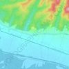
Grad Popovača topographic map

Click on the map to display elevation.

About this map

Name: Grad Popovača topographic map, elevation, terrain.

Location: Grad Popovača, Sisak-Moslavina County, Croatia (45.46036 16.47869 45.65183 16.74861)

Average elevation: 135 m

Minimum elevation: 86 m

Maximum elevation: 479 m

Other topographic maps

Click on a map to view its topography, its elevation and its terrain.

Paklenica

Croatia > Sisak-Moslavina County > Grad Novska

Average elevation: 133 m

Matijevići

Croatia > Sisak-Moslavina County

Average elevation: 168 m

Bobovac

Croatia > Sisak-Moslavina County

Average elevation: 94 m

Gear up for your next adventure:

🧭Orienteering Kit - Tools for map reading and navigation in the wild
🚲Heavy Duty Bike Lock - Secure your bike at the trailhead or during stops
🥾Hiking Leggings - Comfortable leggings for outdoor activities
🧥Fleece Jacket - Warm and lightweight jacket for layering
🥫Freeze-Dried Meals - Lightweight, high-calorie nutrition for multi-day treks

As an Amazon Associate, this site earns from qualifying purchases at no extra cost to you.