Geolocate

Washington topographic map

Click on the map to display elevation.

About this map
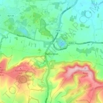
Name: Washington topographic map, elevation, terrain.

Location: Washington, Storrington, Horsham, West Sussex, England, United Kingdom (50.87960 -0.43123 50.93065 -0.37689)

Average elevation: 92 m

Minimum elevation: 14 m

Maximum elevation: 238 m

Other topographic maps

Click on a map to view its topography, its elevation and its terrain.

Cootham

United Kingdom > England > West Sussex > Horsham > Storrington

Average elevation: 51 m

Gear up for your next adventure:

🔦LED Headtorch - Bright and durable light for night activities
🛶Waterproof Dry Bags - Keep electronics and clothes dry during river crossings
⛺Tent Footprint - Protect tent floor and increase durability
💧Collapsible Water Bottle - Space-saving water bottle for outdoor activities
🥾Lightweight Hiking Boots - Boots for comfort and mobility on long hikes

As an Amazon Associate, this site earns from qualifying purchases at no extra cost to you.