Geolocate

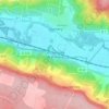
Isles-sur-Suippe topographic map

Click on the map to display elevation.

About this map
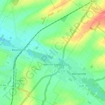
Name: Isles-sur-Suippe topographic map, elevation, terrain.

Location: Isles-sur-Suippe, Reims, Marne, Grand Est, Metropolitan France, 51110, France (49.33386 4.17495 49.38813 4.24416)

Average elevation: 92 m

Minimum elevation: 70 m

Maximum elevation: 136 m

Other topographic maps

Click on a map to view its topography, its elevation and its terrain.
La Chaussée de Damery

France > Grand Est > Marne

Average elevation: 136 m

Reims

France > Grand Est > Marne > Reims

Average elevation: 130 m

Le Mesnil le Huttier

France > Grand Est > Marne > Festigny

Average elevation: 176 m

Les Vingt Verges

France > Grand Est > Marne > Mareuil-le-Port > Le Mornas

Average elevation: 115 m

Gear up for your next adventure:

💧Hydration Pack - Hands-free hydration system for long hikes
🧴Outdoor Sunscreen - High SPF protection for high-altitude UV exposure
👟Sport Hiking Sandals - Breathable footwear for water crossings and camp rest
🏕️Camping Hammock - Integrated protection for sleeping between trees
🥾Hiking Shoes - Durable and comfortable shoes for trail hiking

As an Amazon Associate, this site earns from qualifying purchases at no extra cost to you.