Geolocate

See topographic map

Click on the map to display elevation.

About this map
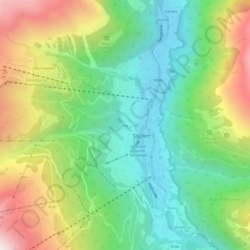
Name: See topographic map, elevation, terrain.

Location: See, Sölden, Bezirk Imst, Tyrol, 6450, Austria (46.94828 10.98347 46.98828 11.02347)

Average elevation: 1,830 m

Minimum elevation: 1,327 m

Maximum elevation: 2,693 m

Gear up for your next adventure:

🧥Packable Rain Jacket - Breathable waterproof layer for unpredictable weather
⛺Camping Essentials - All-in-one gear for a comfortable camping trip
🦶Hiking Shoe Insoles - Added support for high arches and long days on feet
🥾Waterproof Trail Shoes - Shoes designed to handle wet terrain
📷Outdoor Action Camera - Capture high-elevation views and rugged adventures

As an Amazon Associate, this site earns from qualifying purchases at no extra cost to you.