Geolocate

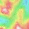
Great End topographic map

Click on the map to display elevation.

About this map

Name: Great End topographic map, elevation, terrain.

Location: Great End, Borrowdale, Cumberland, England, United Kingdom (54.46490 -3.19457 54.46500 -3.19447)

Average elevation: 656 m

Minimum elevation: 234 m

Maximum elevation: 970 m

Other topographic maps

Click on a map to view its topography, its elevation and its terrain.
Tarn at Leaves

United Kingdom > England > Cumberland > Borrowdale

Average elevation: 348 m

Styhead Tarn

United Kingdom > England > Cumberland > Borrowdale

Average elevation: 525 m

Gear up for your next adventure:

🥽Outdoor Goggles - Protective eyewear for outdoor activities
💡LED Camping Lantern - Illuminate your campsite with long-lasting lanterns
🧼Travel Hand Sanitizer - Keep hands clean when water is scarce
🦌Outdoor Trail Camera - Monitor wildlife activity near your favorite spots
🏕️Camping Hammock - Integrated protection for sleeping between trees

As an Amazon Associate, this site earns from qualifying purchases at no extra cost to you.