
Make a donation
Gear up for your next adventure:
As an Amazon Associate, this site earns from qualifying purchases at no extra cost to you.
Garrel topographic map
Click on the map to display elevation.
Make a donation
Gear up for your next adventure:
As an Amazon Associate, this site earns from qualifying purchases at no extra cost to you.
Garrel
Am 10. September 1930 um 14.15 Uhr schlug im Ortsteil Beverbruch ein Meteorit ein. Es ist ein Teil des Meteoriten Oldenburg, der in etwa 4 km Höhe oberhalb der Ortschaft Döhlen in mindestens zwei Hauptteile zerbrach, die in Beverbruch und Bissel (Gemeinde Großenkneten) niedergingen. Das größere Fragment Beverbruch mit einem Gewicht von 11,73 kg befindet sich heute in privater Hand, nachdem 1995 die Tochter des Eigentümers Konrad Meyer es aus der Dauerleihgabe im Museumsdorf Cloppenburg zum Verkauf anbot. Das Fragment „Bissel“ ist seit 2012 verschollen.
Make a donation
Gear up for your next adventure:
As an Amazon Associate, this site earns from qualifying purchases at no extra cost to you.
About this map
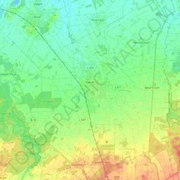
Name: Garrel topographic map, elevation, terrain.
Location: Garrel, Landkreis Cloppenburg, Niedersachsen, 49681, Deutschland (52.88078 7.93450 53.01641 8.12471)
Average elevation: 24 m
Minimum elevation: 7 m
Maximum elevation: 52 m
Make a donation
Gear up for your next adventure:
As an Amazon Associate, this site earns from qualifying purchases at no extra cost to you.
Other topographic maps
Click on a map to view its topography, its elevation and its terrain.
Hoheging
Deutschland > Niedersachsen > Landkreis Cloppenburg > Emstek
Die Bauerschaft Hoheging gehört zum Dreiländereck "HoKeBü", das aus den Gemeinden Hoheging, Kellerhöhe (gehört zur Stadt Cloppenburg) und Bürgermoor (gehört zur Gemeinde Garrel) besteht.
Average elevation: 39 m
Edewechterdamm
Deutschland > Niedersachsen > Landkreis Cloppenburg > Friesoythe
Average elevation: 7 m
Neumarkhausen
Deutschland > Niedersachsen > Landkreis Cloppenburg > Friesoythe
Average elevation: 29 m
Make a donation
Gear up for your next adventure:
As an Amazon Associate, this site earns from qualifying purchases at no extra cost to you.
Make a donation
Gear up for your next adventure:
As an Amazon Associate, this site earns from qualifying purchases at no extra cost to you.
Markhausen
Deutschland > Niedersachsen > Landkreis Cloppenburg > Friesoythe
Ahrensdorf | Altenoythe | Augustendorf | Edewechterdamm | Ellerbrock | Friesoythe | Gehlenberg | Heinfelde | Kampe | Kamperfehn | Markhausen | Mehrenkamp | Neuscharrel | Neuvrees | Pehmertange | Schlingshöhe | Schwaneburg | Schwaneburgermoor | Thüle
Average elevation: 22 m
Make a donation
Gear up for your next adventure:
As an Amazon Associate, this site earns from qualifying purchases at no extra cost to you.
Neuscharrel
Deutschland > Niedersachsen > Landkreis Cloppenburg > Friesoythe
Ahrensdorf | Altenoythe | Augustendorf | Edewechterdamm | Ellerbrock | Friesoythe | Gehlenberg | Heinfelde | Kampe | Kamperfehn | Markhausen | Mehrenkamp | Neuscharrel | Neuvrees | Pehmertange | Schlingshöhe | Schwaneburg | Schwaneburgermoor | Thüle
Average elevation: 8 m
Marienwallfahrtsort Bethen
Deutschland > Niedersachsen > Landkreis Cloppenburg > Cloppenburg
Ambühren | Bethen | Cloppenburg (Kernbereich) | Emstekerfeld | Galgenmoor | Kellerhöhe | Staatsforsten | Stapelfeld | Sternbusch | Schmertheim | Vahren
Average elevation: 44 m
Make a donation
Gear up for your next adventure:
As an Amazon Associate, this site earns from qualifying purchases at no extra cost to you.
Make a donation
Gear up for your next adventure:
As an Amazon Associate, this site earns from qualifying purchases at no extra cost to you.
Schelmkappe
Deutschland > Niedersachsen > Landkreis Cloppenburg > Löningen > Böen
Average elevation: 24 m
Ambühren
Deutschland > Niedersachsen > Landkreis Cloppenburg > Cloppenburg
Ambühren | Bethen | Cloppenburg (Kernbereich) | Emstekerfeld | Galgenmoor | Kellerhöhe | Staatsforsten | Stapelfeld | Sternbusch | Schmertheim | Vahren
Average elevation: 40 m
Make a donation
Gear up for your next adventure:
As an Amazon Associate, this site earns from qualifying purchases at no extra cost to you.
Pirgo
Deutschland > Niedersachsen > Landkreis Cloppenburg > Friesoythe > Altenoythe
Average elevation: 8 m
Make a donation
Gear up for your next adventure:
As an Amazon Associate, this site earns from qualifying purchases at no extra cost to you.
Make a donation
Gear up for your next adventure:
As an Amazon Associate, this site earns from qualifying purchases at no extra cost to you.
Hegel
Deutschland > Niedersachsen > Landkreis Cloppenburg > Lindern (Oldenburg)
Average elevation: 36 m
Make a donation
Gear up for your next adventure:
As an Amazon Associate, this site earns from qualifying purchases at no extra cost to you.
Farwick
Deutschland > Niedersachsen > Landkreis Cloppenburg > Löningen > Neuenbunnen
Average elevation: 26 m
Make a donation
Gear up for your next adventure:
As an Amazon Associate, this site earns from qualifying purchases at no extra cost to you.
Neuvrees
Deutschland > Niedersachsen > Landkreis Cloppenburg > Friesoythe > Neuvrees
Average elevation: 14 m
Altenoythe
Deutschland > Niedersachsen > Landkreis Cloppenburg > Friesoythe > Altenoythe
Ahrensdorf | Altenoythe | Augustendorf | Edewechterdamm | Ellerbrock | Friesoythe | Gehlenberg | Heinfelde | Kampe | Kamperfehn | Markhausen | Mehrenkamp | Neuscharrel | Neuvrees | Pehmertange | Schlingshöhe | Schwaneburg | Schwaneburgermoor | Thüle
Average elevation: 9 m
Make a donation
Gear up for your next adventure:
As an Amazon Associate, this site earns from qualifying purchases at no extra cost to you.
Hollenermoor
Deutschland > Niedersachsen > Landkreis Cloppenburg > Saterland > Hollenermoor
Average elevation: 5 m
Lodbergen
Deutschland > Niedersachsen > Landkreis Cloppenburg > Löningen > Lodbergen
Average elevation: 29 m
Mittelsten Thüle
Deutschland > Niedersachsen > Landkreis Cloppenburg > Friesoythe > Mittelsten Thüle
Average elevation: 18 m
Make a donation
Gear up for your next adventure:
As an Amazon Associate, this site earns from qualifying purchases at no extra cost to you.
Halen
Deutschland > Niedersachsen > Landkreis Cloppenburg
Halen ist ein Ortsteil im Norden der Gemeinde Emstek, Landkreis Cloppenburg, Oldenburger Münsterland und mit einer Fläche von 2.375 Hektar und 1.666 Einwohnern (Stand: 31. März 2016) das größte Dorf der Gemeinde. Sein Gebiet grenzt im Norden an Hoheging und Beverbruch, im Osten an Ahlhorn und Garthe, im…
Average elevation: 52 m
Oldendorf (Lastrup)
Deutschland > Niedersachsen > Landkreis Cloppenburg > Lastrup
Average elevation: 33 m