

Pepperell topographic map
Click on the map to display elevation.
About this map
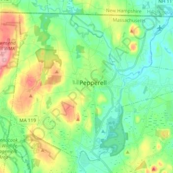
Name: Pepperell topographic map, elevation, terrain.
Location: Pepperell, Middlesex County, Massachusetts, United States (42.62581 -71.65793 42.70483 -71.53241)
Average elevation: 90 m
Minimum elevation: 48 m
Maximum elevation: 184 m
Other topographic maps
Click on a map to view its topography, its elevation and its terrain.

Bowman Park
United States > Massachusetts > Middlesex County > Lexington > East Lexington
Average elevation: 70 m

Picking Conservation Land East
United States > Massachusetts > Middlesex County > Westford
Average elevation: 73 m