Geolocate

Waimate topographic map

Click on the map to display elevation.

About this map

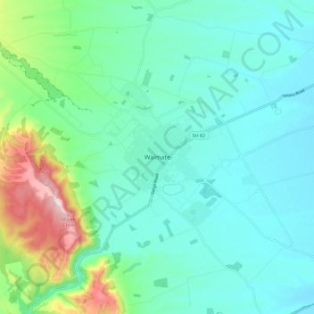
Name: Waimate topographic map, elevation, terrain.

Location: Waimate, Waimate District, Canterbury, 7924, New Zealand (-44.77388 171.00234 -44.69388 171.08234)

Average elevation: 100 m

Minimum elevation: 17 m

Maximum elevation: 408 m

Other topographic maps

Click on a map to view its topography, its elevation and its terrain.

Gear up for your next adventure:

🧥Thermal Fleece Jacket - Versatile insulation for changing mountain temperatures
🔦LED Headtorch - Bright and durable light for night activities
🏕️Camping Hammock - Integrated protection for sleeping between trees
💧Hydration Bladder - Hands-free hydration solution for long treks
🚲MTB Frame Bag - Carry tools and maps directly on your bicycle frame

As an Amazon Associate, this site earns from qualifying purchases at no extra cost to you.