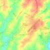
Waco topographic map
Click on the map to display elevation.
About this map

Name: Waco topographic map, elevation, terrain.
Location: Waco, Cleveland County, North Carolina, 28169, United States (35.35434 -81.43741 35.36914 -81.41973)
Average elevation: 276 m
Minimum elevation: 244 m
Maximum elevation: 310 m
Other topographic maps
Click on a map to view its topography, its elevation and its terrain.

Hickory Creek Apartments
United States > North Carolina > Cleveland County > Shelby
Average elevation: 255 m


Moss Lake Park II (Westside)
United States > North Carolina > Cleveland County > Kings Mountain
Average elevation: 231 m