
Thank you for supporting this site ❤️
Make a donation
Make a donation
Gear up for your next adventure:
As an Amazon Associate, this site earns from qualifying purchases at no extra cost to you.
Netherhampton topographic map
Click on the map to display elevation.
Thank you for supporting this site ❤️
Make a donation
Make a donation
Gear up for your next adventure:
As an Amazon Associate, this site earns from qualifying purchases at no extra cost to you.
About this map
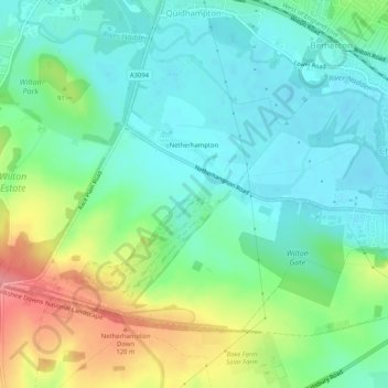
Name: Netherhampton topographic map, elevation, terrain.
Location: Netherhampton, Quidhampton, Wiltshire, England, United Kingdom (51.05182 -1.86889 51.07482 -1.81739)
Average elevation: 73 m
Minimum elevation: 44 m
Maximum elevation: 137 m
Thank you for supporting this site ❤️
Make a donation
Make a donation
Gear up for your next adventure:
As an Amazon Associate, this site earns from qualifying purchases at no extra cost to you.