Geolocate

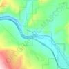
Minturn topographic map

Click on the map to display elevation.

About this map

Name: Minturn topographic map, elevation, terrain.

Location: Minturn, Eagle County, Colorado, United States (39.56736 -106.44823 39.60795 -106.40626)

Average elevation: 2,625 m

Minimum elevation: 2,361 m

Maximum elevation: 3,137 m

Other topographic maps

Click on a map to view its topography, its elevation and its terrain.

Carter Lake

United States > Colorado > Eagle County

Average elevation: 3,359 m

Wolcott

United States > Colorado > Eagle County

Average elevation: 2,239 m

Mount Jackson

United States > Colorado > Eagle County

Average elevation: 3,724 m

Bond

United States > Colorado > Eagle County

Bond is located at coordinates 39°52′28″N 106°41′14″W / 39.8744°N 106.6873°W / 39.8744; -106.6873, 133 miles (214 kilometers) west of Denver at an elevation of 6,739 feet (2,054 m). It is located along the Colorado River, and is at the southern terminus of the Colorado River Headwaters National Scenic Byway.

Average elevation: 2,226 m

Beaver Creek

United States > Colorado > Eagle County

Average elevation: 2,604 m

Gore Lake

United States > Colorado > Eagle County

Average elevation: 3,548 m

Pitkin Lake

United States > Colorado > Eagle County

Average elevation: 3,542 m

Carterville

United States > Colorado > Eagle County

Average elevation: 2,440 m

Rock Creek

United States > Colorado > Eagle County > McCoy

Average elevation: 2,091 m

Meredith

United States > Colorado > Eagle County

Average elevation: 2,592 m

Vail

United States > Colorado > Eagle County

Vail's average elevation is 8,150 feet (2484 m) above sea level. The town has a total area of 4.5 square miles (12 km2), with no lakes (there is, however, at least one pond). Gore Creek flows from east to west through the center of town.

Average elevation: 2,953 m

Meredith

United States > Colorado > Eagle County

Average elevation: 2,592 m

Holy Cross Ridge

United States > Colorado > Eagle County

Average elevation: 3,781 m

Beaver Creek

United States > Colorado > Eagle County

Average elevation: 2,604 m

Wolcott

United States > Colorado > Eagle County

Average elevation: 2,239 m

Edwards Village

United States > Colorado > Eagle County > Edwards

Average elevation: 2,300 m

Beaver Creek

United States > Colorado > Eagle County

Average elevation: 2,726 m

Dotsero

United States > Colorado > Eagle County

Average elevation: 2,021 m

Mount Jackson

United States > Colorado > Eagle County

Average elevation: 3,724 m

Fulford

United States > Colorado > Eagle County

Average elevation: 3,113 m

Suicide Mountain

United States > Colorado > Eagle County

Average elevation: 2,885 m

Gear up for your next adventure:

🩹Compact First Aid Kit - Pre-packed essentials for common trail injuries
🐕Hiking Dog Pack - Let your canine companion carry their own water and food
🧰Emergency Multi-Tool - Compact multi-tool for outdoor survival
⛺Lightweight Camping Tent - Portable shelter optimized for Canadian backcountry camping
☕Camping Coffee Maker - Brew fresh coffee anywhere on the topographic map

As an Amazon Associate, this site earns from qualifying purchases at no extra cost to you.