Geolocate

Buffalo City topographic map

Click on the map to display elevation.

About this map

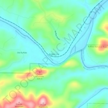
Name: Buffalo City topographic map, elevation, terrain.

Location: Buffalo City, Baxter County, Arkansas, United States (36.14785 -92.46210 36.18785 -92.42210)

Average elevation: 176 m

Minimum elevation: 110 m

Maximum elevation: 351 m

Other topographic maps

Click on a map to view its topography, its elevation and its terrain.

Cotter

United States > Arkansas > Baxter County

Average elevation: 170 m

White River

United States > Arkansas > Baxter County

Average elevation: 148 m

Mountain Home

United States > Arkansas > Baxter County

Average elevation: 254 m

Norfork

United States > Arkansas > Baxter County

Average elevation: 183 m

Lakeview

United States > Arkansas > Baxter County

Average elevation: 222 m

Norfork

United States > Arkansas > Baxter County

Average elevation: 183 m

Lakeview

United States > Arkansas > Baxter County

Average elevation: 222 m

Big Flat

United States > Arkansas > Baxter County

Average elevation: 354 m

Mountain Home

United States > Arkansas > Baxter County

Average elevation: 254 m

Lakeview

United States > Arkansas > Baxter County

Average elevation: 222 m

Cotter

United States > Arkansas > Baxter County > Cotter

Average elevation: 170 m

Gear up for your next adventure:

🥾All-Terrain Hiking Boots - Versatile boots for varied hiking conditions
🧢Hiking Hat - Sun-protective and breathable hats for long treks
🥾Approach Shoes - Shoes designed for climbing approaches and rugged trails
Camping Coffee Maker - Brew fresh coffee anywhere on the topographic map
🥘Camping Cookware Set - Compact nesting pots and pans for trail cooking

As an Amazon Associate, this site earns from qualifying purchases at no extra cost to you.