Geolocate

Nelleva topographic map

Click on the map to display elevation.

About this map

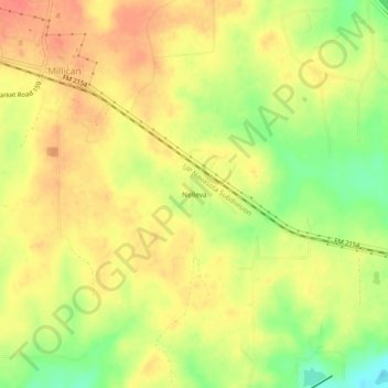
Name: Nelleva topographic map, elevation, terrain.

Location: Nelleva, Brazos County, Texas, 77866, United States (30.43465 -96.20635 30.47465 -96.16635)

Average elevation: 84 m

Minimum elevation: 53 m

Maximum elevation: 103 m

Other topographic maps

Click on a map to view its topography, its elevation and its terrain.

College Station

United States > Texas > Brazos County

Average elevation: 87 m

College Station

United States > Texas > Brazos County

Average elevation: 87 m

Bryan

United States > Texas > Brazos County

Average elevation: 92 m

Wixon Valley

United States > Texas > Brazos County

Average elevation: 99 m

Bryan

United States > Texas > Brazos County

Average elevation: 92 m

College Station

United States > Texas > Brazos County

Average elevation: 87 m

Bryan

United States > Texas > Brazos County

Average elevation: 92 m

Bryan

United States > Texas > Brazos County

Average elevation: 92 m

Gear up for your next adventure:

🌬️Windproof Camp Stove - Efficient cooking even on exposed mountain peaks
🥾Hiking Boots - Sturdy boots providing ankle support and traction on rugged trails
🔦UV Flashlight - Detect minerals or specific insects in the dark
🥾Mountain Trail Shoes - High-traction shoes for mountain trails
🔭Compact Binoculars - Lightweight optics for scouting trails and wildlife

As an Amazon Associate, this site earns from qualifying purchases at no extra cost to you.