Geolocate

Park Rapids topographic map

Click on the map to display elevation.

About this map
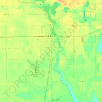
Name: Park Rapids topographic map, elevation, terrain.

Location: Park Rapids, Hubbard County, Minnesota, United States (46.87953 -95.10081 46.94549 -95.00785)

Average elevation: 439 m

Minimum elevation: 422 m

Maximum elevation: 454 m

Other topographic maps

Click on a map to view its topography, its elevation and its terrain.
Dorset

United States > Minnesota > Hubbard County

Average elevation: 445 m

Emmaville

United States > Minnesota > Hubbard County

Average elevation: 458 m

Lake George

United States > Minnesota > Hubbard County

Average elevation: 435 m

Gear up for your next adventure:

🛶Canoe Life Vest - Safety vest for water sports
🥾Trail Hiking Boots - Supportive boots for rough trails
🧊Insulated Water Bottle - Keeps drinks cold in summer and prevents freezing in winter
🔋Solar Power Bank - Keep your GPS and devices charged during long outdoor trips
🥾Trekking Poles - Adjustable trekking poles to reduce knee stress and improve stability

As an Amazon Associate, this site earns from qualifying purchases at no extra cost to you.