Geolocate

Villatora topographic map

Click on the map to display elevation.

About this map

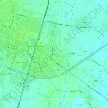
Name: Villatora topographic map, elevation, terrain.

Location: Villatora, Saonara, Province of Padua, Veneto, 35027, Italy (45.36607 11.94660 45.40607 11.98660)

Average elevation: 10 m

Minimum elevation: 5 m

Maximum elevation: 14 m

Other topographic maps

Click on a map to view its topography, its elevation and its terrain.

Teolo

Italy > Veneto > Province of Padua

Average elevation: 84 m

Padua

Italy > Veneto > Province of Padua

Average elevation: 13 m

Gear up for your next adventure:

🧴First Aid Kit - Essential first aid supplies for outdoor emergencies
🧤Thermal Hiking Gloves - Grip-enhanced gloves for cold-weather altitude trekking
🧥Softshell Hiking Jacket - The perfect balance of wind protection and breathability
🚲Bike Repair Kit - Essential tools for on-trail mechanical issues
🧣Merino Neck Gaiter - Protects against wind, sun, and cold at high altitudes

As an Amazon Associate, this site earns from qualifying purchases at no extra cost to you.