
Padua topographic map
Click on the map to display elevation.
About this map
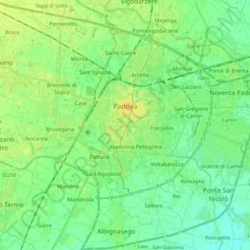
Name: Padua topographic map, elevation, terrain.
Location: Padua, Province of Padua, Veneto, 35121-35143, Italy (45.33957 11.80541 45.45737 11.97644)
Average elevation: 12 m
Minimum elevation: 4 m
Maximum elevation: 25 m
Other topographic maps
Click on a map to view its topography, its elevation and its terrain.
Cascina Norbiato
Italy > Veneto > Province of Padua > Villafranca Padovana > Taggì di Sotto
Average elevation: 17 m