Geolocate

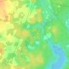
Middle Ohio topographic map

Click on the map to display elevation.

About this map

Name: Middle Ohio topographic map, elevation, terrain.

Location: Middle Ohio, Municipality of the District of Shelburne, Shelburne County, Nova Scotia, B0T 1J0, Canada (43.87614 -65.47224 43.95849 -65.36832)

Average elevation: 61 m

Minimum elevation: 43 m

Maximum elevation: 98 m

Other topographic maps

Click on a map to view its topography, its elevation and its terrain.

Gear up for your next adventure:

⛺Camping Tent - Weather-resistant tents suitable for 2 to 6 people
⛺Lightweight Camping Tent - Portable shelter optimized for Canadian backcountry camping
🧴Sunscreen SPF - Broad-spectrum sunscreen for outdoor activities
💡Portable Camping Lamp - Rechargeable lamp for campsite lighting
🧢Hiking Sun Hat - Wide-brimmed protection for exposed mountain ridges

As an Amazon Associate, this site earns from qualifying purchases at no extra cost to you.