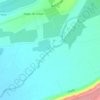
Punitaqui topographic map
Click on the map to display elevation.
About this map

Name: Punitaqui topographic map, elevation, terrain.
Location: Punitaqui, Provincia de Limarí, Coquimbo Region, Chile (-31.17652 -71.55138 -30.70893 -71.01897)
Average elevation: 656 m
Minimum elevation: 58 m
Maximum elevation: 1,537 m
Other topographic maps
Click on a map to view its topography, its elevation and its terrain.

Plaza de Armas
Chile > Coquimbo Region > Provincia de Limarí > Ovalle > Sotaquí
Average elevation: 290 m