Geolocate

El Teniente topographic map

Click on the map to display elevation.

About this map

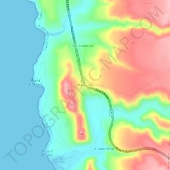
Name: El Teniente topographic map, elevation, terrain.

Location: El Teniente, Ovalle, Provincia de Limarí, Coquimbo Region, Chile (-31.00814 -71.65811 -30.96814 -71.61811)

Average elevation: 69 m

Minimum elevation: 0 m

Maximum elevation: 188 m

Other topographic maps

Click on a map to view its topography, its elevation and its terrain.

Gear up for your next adventure:

🧥Waterproof Hiking Jacket - Protect yourself from rain and wind while hiking
🔋Emergency Crank Radio - Weather alerts and power without needing batteries
🥾Trekking Poles - Adjustable trekking poles to reduce knee stress and improve stability
🏕️Camping Hammock - Integrated protection for sleeping between trees
🧴Bear Spray Holster - Quick-access carry for essential Canadian wilderness safety

As an Amazon Associate, this site earns from qualifying purchases at no extra cost to you.