Geolocate

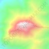
Noor topographic map

Click on the map to display elevation.

About this map

Name: Noor topographic map, elevation, terrain.

Location: Noor, بخش مرکزی شهرستان نور, Nur County, Mazandaran Province, Iran (36.56450 51.98922 36.58341 52.04098)

Average elevation: -22 m

Minimum elevation: -29 m

Maximum elevation: 3 m

Other topographic maps

Click on a map to view its topography, its elevation and its terrain.

Gear up for your next adventure:

🥾Trail Hiking Socks - Comfortable socks to prevent blisters and fatigue
🛏️Camping Sleeping Mat - Comfortable mats for sleeping outdoors
🧥Thermal Fleece Jacket - Versatile insulation for changing mountain temperatures
🥾Durable Hiking Shoes - Long-lasting shoes for frequent hiking
💧Hydration Bladder - Hands-free hydration solution for long treks

As an Amazon Associate, this site earns from qualifying purchases at no extra cost to you.