Geolocate

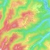
Bobovica topographic map

Click on the map to display elevation.

About this map

Name: Bobovica topographic map, elevation, terrain.

Location: Bobovica, Grad Samobor, Zagreb County, Croatia (45.82026 15.70707 45.83630 15.73267)

Average elevation: 140 m

Minimum elevation: 127 m

Maximum elevation: 275 m

Other topographic maps

Click on a map to view its topography, its elevation and its terrain.
Beder

Croatia > Zagreb County > Grad Samobor

Average elevation: 414 m

Gear up for your next adventure:

🚑Survival Whistle - Signal for help across long distances in mountains
🧴Sunscreen SPF - Broad-spectrum sunscreen for outdoor activities
🔪Outdoor Multitool - Versatile tool for repairs and food prep in the wild
🧤Thermal Hiking Gloves - Grip-enhanced gloves for cold-weather altitude trekking
🔥Camping Stove - Portable stoves to cook outdoors with ease

As an Amazon Associate, this site earns from qualifying purchases at no extra cost to you.