Geolocate

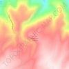
Antelope Hills topographic map

Click on the map to display elevation.

About this map

Name: Antelope Hills topographic map, elevation, terrain.

Location: Antelope Hills, Natrona County, Wyoming, United States (43.03104 -106.33750 43.12127 -106.27628)

Average elevation: 1,711 m

Minimum elevation: 1,643 m

Maximum elevation: 1,797 m

Other topographic maps

Click on a map to view its topography, its elevation and its terrain.
Casper Mountain

United States > Wyoming > Natrona County

Casper Mountain, an anticline, is located at the north end of the Laramie Mountains overlooking Casper, Wyoming along the North Platte River. At a top elevation of 8,130 feet (2,478 m), the geological feature rises approximately 3,000 feet (914 m) above Casper.

Average elevation: 2,315 m

Natrona

United States > Wyoming > Natrona County

Average elevation: 1,719 m

Devils Gate

United States > Wyoming > Natrona County

Average elevation: 1,857 m

Independence Rock

United States > Wyoming > Natrona County

Average elevation: 1,802 m

Casper

United States > Wyoming > Natrona County

Average elevation: 1,635 m

Casper

United States > Wyoming > Natrona County > Casper

Average elevation: 1,727 m

Bar Nunn

United States > Wyoming > Natrona County

Average elevation: 1,619 m

Gear up for your next adventure:

💡LED Camping Lantern - Illuminate your campsite with long-lasting lanterns
🦶Hiking Shoe Insoles - Added support for high arches and long days on feet
🥾Approach Shoes - Shoes designed for climbing approaches and rugged trails
🧥Fleece Jacket - Warm and lightweight jacket for layering
📷Outdoor Action Camera - Capture high-elevation views and rugged adventures

As an Amazon Associate, this site earns from qualifying purchases at no extra cost to you.