Geolocate

Casper topographic map

Click on the map to display elevation.

About this map

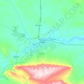
Name: Casper topographic map, elevation, terrain.

Location: Casper, Natrona County, Wyoming, 82601, United States (42.69012 -106.48514 43.01012 -106.16514)

Average elevation: 1,727 m

Minimum elevation: 1,535 m

Maximum elevation: 2,493 m

Gear up for your next adventure:

💡Compact LED Flashlight - Powerful and portable flashlight for outdoor use
🧦Outdoor Socks - Durable socks designed for hiking and outdoor sports
🥾Waterproof Hiking Boots - Essential footwear for rugged terrain and wet Canadian trails
🛏️Sleeping Bag - Warm and compact sleeping bags for outdoor camping
🛏️Camping Sleeping Mat - Comfortable mats for sleeping outdoors

As an Amazon Associate, this site earns from qualifying purchases at no extra cost to you.