Geolocate

Tianjingguan topographic map

Click on the map to display elevation.

About this map

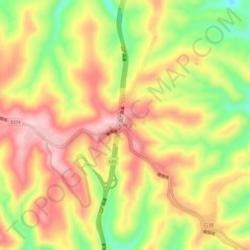
Name: Tianjingguan topographic map, elevation, terrain.

Location: Tianjingguan, Shanxi, China (35.33546 112.79331 35.37546 112.83331)

Average elevation: 864 m

Minimum elevation: 738 m

Maximum elevation: 961 m

Other topographic maps

Click on a map to view its topography, its elevation and its terrain.

Qin County

China > Shanxi > Changzhi

Average elevation: 1,139 m

Xi County

China > Shanxi

The county is located on the western edge of the Lüliang Mountains, with an average elevation ranging from 950 metres (3,120 ft) to 1,300 metres (4,300 ft) above sea level. Xi County's highest point is 1,953 metres (6,407 ft) above sea level.

Average elevation: 1,244 m

Datong

China > Shanxi

Average elevation: 1,339 m

Jiexiu City

China > Shanxi > Jinzhong City

Average elevation: 1,086 m

Gear up for your next adventure:

🪑Insulated Seat Pad - Protect your seat from cold rocks and wet logs
🔭Compact Monocular - One-handed bird watching and trail spotting
🦟Insect Repellent - Keep mosquitoes and black flies away in wooded areas
🧴Sunscreen SPF - Broad-spectrum sunscreen for outdoor activities
🥾Trail Hiking Socks - Comfortable socks to prevent blisters and fatigue

As an Amazon Associate, this site earns from qualifying purchases at no extra cost to you.