Geolocate

Hillview topographic map

Click on the map to display elevation.

About this map
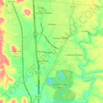
Name: Hillview topographic map, elevation, terrain.

Location: Hillview, Bullitt County, Kentucky, 40129, United States (38.01750 -85.71003 38.08584 -85.65524)

Average elevation: 162 m

Minimum elevation: 113 m

Maximum elevation: 236 m

Gear up for your next adventure:

🥾Approach Boots - Comfortable boots for hiking and climbing approaches
🗺️Topographic Maps - Detailed maps to explore trails, mountains, and wilderness areas
🦟Insect Repellent - Keep mosquitoes and black flies away in wooded areas
💡Portable Camping Lamp - Rechargeable lamp for campsite lighting
🌬️Windproof Camp Stove - Efficient cooking even on exposed mountain peaks

As an Amazon Associate, this site earns from qualifying purchases at no extra cost to you.