Geolocate

High Bank Lake topographic map

Click on the map to display elevation.

About this map

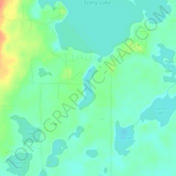
Name: High Bank Lake topographic map, elevation, terrain.

Location: High Bank Lake, Cass County, Minnesota, United States (46.95002 -94.49897 46.95684 -94.49479)

Average elevation: 425 m

Minimum elevation: 412 m

Maximum elevation: 459 m

Other topographic maps

Click on a map to view its topography, its elevation and its terrain.

Whipholt

United States > Minnesota > Cass County

Average elevation: 403 m

Moose Lake

United States > Minnesota > Cass County

Average elevation: 442 m

Inguadona

United States > Minnesota > Cass County

Average elevation: 404 m

Boy Lake

United States > Minnesota > Cass County

Average elevation: 400 m

Birch Lake

United States > Minnesota > Cass County > Hackensack

Average elevation: 425 m

Leech Lake

United States > Minnesota > Cass County

Average elevation: 404 m

Bena

United States > Minnesota > Cass County > Bena

Average elevation: 398 m

East Gull Lake

United States > Minnesota > Cass County

Average elevation: 370 m

Hackensack

United States > Minnesota > Cass County > Hackensack

Average elevation: 423 m

Pine River

United States > Minnesota > Cass County

Average elevation: 395 m

Gear up for your next adventure:

🐕Hiking Dog Pack - Let your canine companion carry their own water and food
🥾Trekking Boots - Durable boots for long-distance trekking
🥾Approach Shoes - Shoes designed for climbing approaches and rugged trails
🥾Hiking Gaiters - Protect legs and shoes from mud, snow, and debris
👟Leg Gaiters - Keep debris, mud, and snow out of your boots

As an Amazon Associate, this site earns from qualifying purchases at no extra cost to you.