Geolocate

Williams Village topographic map

Click on the map to display elevation.

About this map
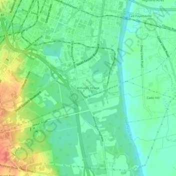
Name: Williams Village topographic map, elevation, terrain.

Location: Williams Village, Fayetteville, Cumberland County, North Carolina, 28301, United States (35.01016 -78.88919 35.05016 -78.84919)

Average elevation: 30 m

Minimum elevation: 11 m

Maximum elevation: 67 m

Other topographic maps

Click on a map to view its topography, its elevation and its terrain.
Gear up for your next adventure:

🎒Fully Waterproof Backpack - Total protection for photography gear and electronics
💡Portable Camping Lamp - Rechargeable lamp for campsite lighting
🕶️Polarized Sunglasses - Reduces glare from snow and water at high elevations
🧦Merino Wool Socks - Moisture-wicking comfort for long-distance hiking
🥾Mountain Hiking Shoes - Shoes with superior grip for mountainous terrain

As an Amazon Associate, this site earns from qualifying purchases at no extra cost to you.