Geolocate

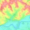
Penne topographic map

Click on the map to display elevation.

About this map

Name: Penne topographic map, elevation, terrain.

Location: Penne, Albi, Tarn, Occitania, Metropolitan France, 81140, France (44.03994 1.65270 44.11849 1.79567)

Average elevation: 287 m

Minimum elevation: 98 m

Maximum elevation: 491 m

Other topographic maps

Click on a map to view its topography, its elevation and its terrain.
Le Bez

France > Occitania > Tarn > Mirandol-Bourgnounac

Average elevation: 373 m

La Mothe

France > Occitania > Tarn > Castelnau-de-Lévis

Average elevation: 203 m

Gear up for your next adventure:

🦶Anti-Blister Balm - Prevents friction and hotspots during long ascents
🔪Outdoor Multitool - Versatile tool for repairs and food prep in the wild
🔋Emergency Crank Radio - Weather alerts and power without needing batteries
🥾Waterproof Hiking Boots - Boots keeping your feet dry in wet conditions
🥾Trail Hiking Shoes - Durable shoes designed for rugged trails

As an Amazon Associate, this site earns from qualifying purchases at no extra cost to you.