Tarn topographic maps
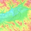
Click on a map to view its topography, its elevation and its terrain.


Saint-Pierre-de-Trivisy
The commune has an average elevation of 618 metres (2,028 ft) and an area of 36.09 square kilometres (13.93 sq mi). Its population in 2018 was 621.
Average elevation: 568 m





Castres
Castres is located at an altitude of 172 metres (564 feet) above sea level. It is located 45 km (28 mi) south-southeast of Albi, the préfecture (capital) of Tarn, and 79 km (49 mi) east of Toulouse, the capital of Occitania. Castres is intersected from north to south by the rivers Agout and Durenque.
Average elevation: 230 m