Geolocate

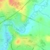
Patterdown topographic map

Click on the map to display elevation.

About this map

Name: Patterdown topographic map, elevation, terrain.

Location: Patterdown, Chippenham, Wiltshire, England, SN15 2NR, United Kingdom (51.42935 -2.15318 51.46935 -2.11318)

Average elevation: 65 m

Minimum elevation: 39 m

Maximum elevation: 109 m

Other topographic maps

Click on a map to view its topography, its elevation and its terrain.
Monkton Park

United Kingdom > England > Wiltshire > Chippenham

Average elevation: 59 m

Gear up for your next adventure:

🥾Waterproof Hiking Boots - Boots keeping your feet dry in wet conditions
🥾Hiking Shorts - Breathable shorts suitable for summer hikes
🕯️Camping Lantern - Illuminates your entire campsite with high-efficiency LEDs
⛺Lightweight Camping Tent - Portable shelter optimized for Canadian backcountry camping
🛌Insulated Sleeping Pad - Critical thermal barrier between you and the cold ground

As an Amazon Associate, this site earns from qualifying purchases at no extra cost to you.