Geolocate

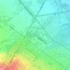
Mladost topographic map

Click on the map to display elevation.

About this map

Name: Mladost topographic map, elevation, terrain.

Location: Mladost, Stolichna, Sofia-City, Bulgaria (42.62008 23.35796 42.67501 23.41942)

Average elevation: 587 m

Minimum elevation: 539 m

Maximum elevation: 714 m

Other topographic maps

Click on a map to view its topography, its elevation and its terrain.

м. Манов камък

Bulgaria > Sofia-City > Plana

Average elevation: 1,183 m

Бачун

Bulgaria > Sofia-City > Pancharevo

Average elevation: 976 m

SPZ Moderno predgradie

Bulgaria > Sofia-City > Lyulin > Sofia

Average elevation: 551 m

Pasarel

Bulgaria > Sofia-City > Dolni Pasarel

The Pasarel dam and reservoir is located 20 km to the southeast of Sofia, Bulgaria at an altitude of 700 m.

Average elevation: 822 m
m. Zagranya

Bulgaria > Sofia-City > Bankia > Klisura

Average elevation: 799 m

Gear up for your next adventure:

⛺Camping Tent - Weather-resistant tents suitable for 2 to 6 people
🔦LED Headtorch - Bright and durable light for night activities
🔦UV Flashlight - Detect minerals or specific insects in the dark
🧥Thermal Layer - Insulating layer for cold outdoor conditions
🐕Hiking Dog Pack - Let your canine companion carry their own water and food

As an Amazon Associate, this site earns from qualifying purchases at no extra cost to you.