Geolocate

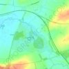
Stapleford topographic map

Click on the map to display elevation.

About this map

Name: Stapleford topographic map, elevation, terrain.

Location: Stapleford, Freeby, Saxby, Melton, Leicestershire, England, LE14 2SH, United Kingdom (52.73548 -0.82260 52.77548 -0.78260)

Average elevation: 95 m

Minimum elevation: 75 m

Maximum elevation: 137 m

Other topographic maps

Click on a map to view its topography, its elevation and its terrain.
Langham Brook

United Kingdom > England > Leicestershire > Melton > Saxby > Freeby

Average elevation: 94 m

Gear up for your next adventure:

🥤Collapsible Travel Cup - Saves space and weight in your mess kit
🪑Insulated Seat Pad - Protect your seat from cold rocks and wet logs
🔦LED Headlamp - Hands-free lighting for early morning starts or late finishes
🧥Softshell Jacket - Windproof and breathable jacket for hiking
🔪Outdoor Multitool - Versatile tool for repairs and food prep in the wild

As an Amazon Associate, this site earns from qualifying purchases at no extra cost to you.