Geolocate

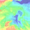
En Nazla topographic map

Click on the map to display elevation.

About this map

Name: En Nazla topographic map, elevation, terrain.

Location: En Nazla, Faiyum, Egypt (29.28408 30.63140 29.32408 30.67140)

Average elevation: -2 m

Minimum elevation: -27 m

Maximum elevation: 11 m

Other topographic maps

Click on a map to view its topography, its elevation and its terrain.

الكعابي الجديدة

Egypt > Faiyum

Average elevation: 19 m

Youssef Al Sediq City

Egypt > Faiyum

Average elevation: 7 m

Lake Qaroun

Egypt > Faiyum

Average elevation: 33 m

Faiyum Oasis

Egypt > Faiyum

Average elevation: 32 m

Al Zohor District Village

Egypt > Faiyum

Average elevation: 36 m

New Al Fayoum City

Egypt > Faiyum

Average elevation: 59 m

Wadi Al Rayyan National Park

Egypt > Faiyum

Average elevation: 47 m

Watermelon Valley

Egypt > Faiyum

Average elevation: -15 m

First Al Nagarin

Egypt > Faiyum

Average elevation: 23 m

Youssef Al Sediq City

Egypt > Faiyum

Average elevation: 7 m

First Al Nagarin

Egypt > Faiyum

Average elevation: 23 m

Gear up for your next adventure:

🥾Mountain Trail Shoes - High-traction shoes for mountain trails
🦟Insect Repellent - Keep mosquitoes and black flies away in wooded areas
🥾Waterproof Hiking Boots - Essential footwear for rugged terrain and wet Canadian trails
🔋Emergency Crank Radio - Weather alerts and power without needing batteries
🥾Hiking Shorts - Breathable shorts suitable for summer hikes

As an Amazon Associate, this site earns from qualifying purchases at no extra cost to you.