Geolocate

Dharmadom topographic map

Click on the map to display elevation.

About this map

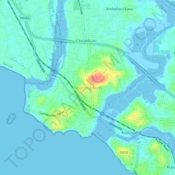
Name: Dharmadom topographic map, elevation, terrain.

Location: Dharmadom, Thalassery, Kannur, Kerala, 670106, India (11.75671 75.44855 11.79671 75.48855)

Average elevation: 8 m

Minimum elevation: -4 m

Maximum elevation: 50 m

Other topographic maps

Click on a map to view its topography, its elevation and its terrain.

Eranholi

India > Kerala > Thalassery > Thalassery

Average elevation: 16 m

Manatheri

India > Kerala > Thalassery > Kaitheri > Manantheri

Average elevation: 63 m

Kotheri

India > Kerala > Thalassery > Nagavalavu

Average elevation: 77 m

Pattiam

India > Kerala > Thalassery > Cheruvanchery

Average elevation: 80 m

Kanakamala

India > Kerala > Thalassery > Mekkunnu > Mukkilpeedika

Average elevation: 21 m

Arayalthara

India > Kerala > Thalassery > Aniyaram

Average elevation: 19 m

Kuthuparamba

India > Kerala > Thalassery > Koothuparamba

Average elevation: 61 m

Kadirur

India > Kerala > Thalassery > Kadirur

Average elevation: 18 m

Panoor

India > Kerala > Thalassery > Mekkunnu

Average elevation: 19 m

Mooryad Centre

India > Kerala > Thalassery > Koothuparamba

Average elevation: 63 m

New Mahe

India > Kerala > Thalassery > Chokli

Average elevation: 17 m

Kallerikkara

India > Kerala > Thalassery > Mattannur

Average elevation: 53 m

Kannavam

India > Kerala > Thalassery

Average elevation: 73 m

Gear up for your next adventure:

🧣Merino Neck Gaiter - Protects against wind, sun, and cold at high altitudes
🛰️Satellite Messenger - Emergency communication for areas with no cell service
🧥Waterproof Hiking Jacket - Protect yourself from rain and wind while hiking
🧢Outdoor Visor - Breathable visor for sunny hikes
🔥Camping Stove - Portable stoves to cook outdoors with ease

As an Amazon Associate, this site earns from qualifying purchases at no extra cost to you.