Geolocate

Laxne topographic map

Click on the map to display elevation.

About this map

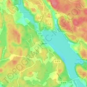
Name: Laxne topographic map, elevation, terrain.

Location: Laxne, Gnesta kommun, Södermanland County, 647 92, Sweden (59.14489 17.16933 59.18489 17.20933)

Average elevation: 42 m

Minimum elevation: 4 m

Maximum elevation: 85 m

Other topographic maps

Click on a map to view its topography, its elevation and its terrain.

Gnesta kommun

Sweden > Södermanland County

Average elevation: 42 m

Lacka

Sweden > Södermanland County

Average elevation: 1 m

Gear up for your next adventure:

🧊Portable Cooler - Keep food and drinks cold during outdoor adventures
🧴Sunscreen SPF - Broad-spectrum sunscreen for outdoor activities
🛶Waterproof Dry Bags - Keep electronics and clothes dry during river crossings
🧢Sun Protection Cap - Breathable cap to protect from sun exposure
🧶550 Survival Paracord - Versatile utility cord for emergency repairs and rigging

As an Amazon Associate, this site earns from qualifying purchases at no extra cost to you.