Geolocate

Olzheim topographic map

Click on the map to display elevation.

About this map
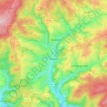
Name: Olzheim topographic map, elevation, terrain.

Location: Olzheim, Prüm, Eifelkreis Bitburg-Prüm, Rijnland-Palts, Duitsland (50.25397 6.39576 50.29788 6.48370)

Average elevation: 569 m

Minimum elevation: 475 m

Maximum elevation: 677 m

Other topographic maps

Click on a map to view its topography, its elevation and its terrain.

Gear up for your next adventure:

🧢Hiking Sun Hat - Wide-brimmed protection for exposed mountain ridges
🥾Hiking Shorts - Breathable shorts suitable for summer hikes
⛺Camping Tent - Weather-resistant tents suitable for 2 to 6 people
🥾Trail Hiking Boots - Supportive boots for rough trails
⛺Family Camping Tent - Spacious tent suitable for family camping trips

As an Amazon Associate, this site earns from qualifying purchases at no extra cost to you.