
Tuktut Nogait National Park topographic map
Interactive map
Click on the map to display elevation.
About this map
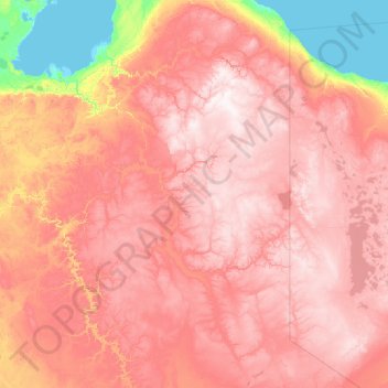
Name: Tuktut Nogait National Park topographic map, elevation, terrain.
Location: Tuktut Nogait National Park, Northwest Territories, Canada (67.74750 -123.33251 69.70024 -119.85984)
Average elevation: 425 m
Minimum elevation: -1 m
Maximum elevation: 867 m
Northwest Territories trails, hiking, mountain biking, running and outdoor activities
Other topographic maps
Click on a map to view its topography, its elevation and its terrain.