Geolocate

Bagui topographic map

Click on the map to display elevation.

About this map

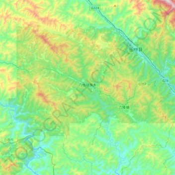
Name: Bagui topographic map, elevation, terrain.

Location: Bagui, Tianlin County, Baise, Guangxi, China (24.11013 105.81611 24.33587 106.18953)

Average elevation: 575 m

Minimum elevation: 201 m

Maximum elevation: 1,622 m

Other topographic maps

Click on a map to view its topography, its elevation and its terrain.

Weiliu

China > Guangxi > Tianlin County > Bagui

Average elevation: 669 m

Gear up for your next adventure:

🥘Camping Cookware Set - Compact nesting pots and pans for trail cooking
🏃Hydration Running Vest - Carry water and maps close to your body for speed
🛌Down Sleeping Bag - Superior warmth-to-weight ratio for cold nights
🧦Merino Wool Socks - Moisture-wicking comfort for long-distance hiking
🥾Approach Boots - Comfortable boots for hiking and climbing approaches

As an Amazon Associate, this site earns from qualifying purchases at no extra cost to you.