

Ireland topographic map
Click on the map to display elevation.
About this map

Name: Ireland topographic map, elevation, terrain.
Location: Ireland (51.22200 -11.01338 55.63600 -5.07778)
Average elevation: 42 m
Minimum elevation: -3 m
Maximum elevation: 832 m
Other topographic maps
Click on a map to view its topography, its elevation and its terrain.





















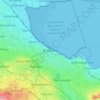
Greystones
Greystones is located south of the site of an ancient castle of the Barony of Rathdown. There was a hamlet which, like Rathdown Castle, was known as Rathdown, and which appeared on a 1712 map. This site occupied an area now known as the Grove, north of Greystones harbour, but only the ruins of a chapel, St.…
Average elevation: 49 m





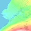
















Donacarney
Ireland > County Meath > The Municipal District of Laytown — Bettystown
Average elevation: 14 m