Geolocate

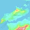
Brandon topographic map

Click on the map to display elevation.

About this map

Name: Brandon topographic map, elevation, terrain.

Location: Brandon, Kenmare Municipal District, County Kerry, Munster, Ireland (52.24739 -10.18218 52.28739 -10.14218)

Average elevation: 71 m

Minimum elevation: 0 m

Maximum elevation: 374 m

Other topographic maps

Click on a map to view its topography, its elevation and its terrain.

Gear up for your next adventure:

❄️Traction Ice Cleats - Slip-on spikes for icy trails and winter hiking
🍽️Titanium Camping Spork - Ultralight and indestructible eating utensil
🧴Bear Spray Holster - Quick-access carry for essential Canadian wilderness safety
🛁Quick-Dry Microfiber Towel - Space-saving towel that dries rapidly on the move
🧭GPS Handheld Device - Reliable GPS navigation for outdoor adventures

As an Amazon Associate, this site earns from qualifying purchases at no extra cost to you.