Geolocate

Clarkridge topographic map

Click on the map to display elevation.

About this map

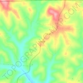
Name: Clarkridge topographic map, elevation, terrain.

Location: Clarkridge, Baxter County, Arkansas, 72623, United States (36.45784 -92.37127 36.49784 -92.33127)

Average elevation: 240 m

Minimum elevation: 185 m

Maximum elevation: 307 m

Other topographic maps

Click on a map to view its topography, its elevation and its terrain.

Cotter

United States > Arkansas > Baxter County

Average elevation: 170 m

White River

United States > Arkansas > Baxter County

Average elevation: 148 m

Mountain Home

United States > Arkansas > Baxter County

Average elevation: 254 m

Norfork

United States > Arkansas > Baxter County

Average elevation: 183 m

Lakeview

United States > Arkansas > Baxter County

Average elevation: 222 m

Norfork

United States > Arkansas > Baxter County

Average elevation: 183 m

Lakeview

United States > Arkansas > Baxter County

Average elevation: 222 m

Big Flat

United States > Arkansas > Baxter County

Average elevation: 354 m

Mountain Home

United States > Arkansas > Baxter County

Average elevation: 254 m

Lakeview

United States > Arkansas > Baxter County

Average elevation: 222 m

Mountain Home

United States > Arkansas > Baxter County

Average elevation: 254 m

Cotter

United States > Arkansas > Baxter County > Cotter

Average elevation: 170 m

Gear up for your next adventure:

🎒Backpack Rain Cover - External shield to keep your entire pack dry
🥫Freeze-Dried Meals - Lightweight, high-calorie nutrition for multi-day treks
🧦Outdoor Socks - Durable socks designed for hiking and outdoor sports
🧢Outdoor Visor - Breathable visor for sunny hikes
🧢Hiking Sun Hat - Wide-brimmed protection for exposed mountain ridges

As an Amazon Associate, this site earns from qualifying purchases at no extra cost to you.