Geolocate

Cwmgiedd topographic map

Click on the map to display elevation.

About this map

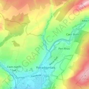
Name: Cwmgiedd topographic map, elevation, terrain.

Location: Cwmgiedd, Ystradgynlais, Powys, Wales, SA9 1LS, United Kingdom (51.76756 -3.77926 51.80756 -3.73926)

Average elevation: 162 m

Minimum elevation: 68 m

Maximum elevation: 301 m

Gear up for your next adventure:

🩹Compact First Aid Kit - Pre-packed essentials for common trail injuries
🛶Kayak Accessories - Essential gear for safe and fun kayaking adventures
🥾Durable Hiking Shoes - Long-lasting shoes for frequent hiking
🥾Hiking Shoes - Durable and comfortable shoes for trail hiking
🕶️Polarized Sunglasses - Protect your eyes with durable polarized lenses

As an Amazon Associate, this site earns from qualifying purchases at no extra cost to you.