Geolocate

Keenthorne topographic map

Click on the map to display elevation.

About this map

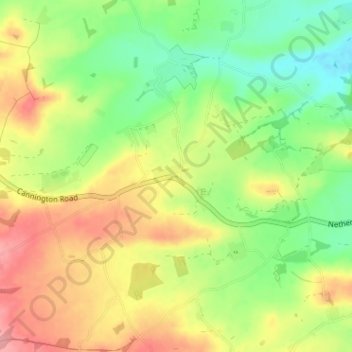
Name: Keenthorne topographic map, elevation, terrain.

Location: Keenthorne, Fiddington, Sedgemoor, Somerset, England, TA5 1HZ, United Kingdom (51.12873 -3.13784 51.16873 -3.09784)

Average elevation: 52 m

Minimum elevation: 6 m

Maximum elevation: 106 m

Other topographic maps

Click on a map to view its topography, its elevation and its terrain.

Gear up for your next adventure:

Camping Tent - Weather-resistant tents suitable for 2 to 6 people
🧤Rechargeable Heated Gloves - Extreme warmth for Canadian winter expeditions
🥘Camping Cookware Set - Compact nesting pots and pans for trail cooking
🔭Outdoor Binoculars - Lightweight binoculars for birdwatching and hiking
🌡️Emergency Mylar Blankets - Compact thermal protection for unexpected nights outdoors

As an Amazon Associate, this site earns from qualifying purchases at no extra cost to you.